-
Our Community
-
- Our Community About Florence City Newsletter News & Recognition Events & Activities City Calendar Florence Events Center Calendar Chamber Calendar RiverCal Siuslaw Library Calendar Schools Siuslaw School District Lane Community College
- Airport City Projects Directory Doing Business Health Care Resources Library Local Media Rainfall Report Transportation Parks & Trails Directory
- Public Safety City of Florence Police Lane County Sheriff's Office Oregon State Police US Coast Guard - Siuslaw Station Western Lane Fire & EMS Authority Organizations Florence Area Chamber of Commerce Florence Events Center Florence Senior Center Port of Siuslaw Siuslaw Vision
-
- Doing Business
-
Welcome Visitors
-
- About Florence Community Amenities Airport Florence Events Center Library Parks & Trails Directory Public Art Senior Center
- Eat, Shop, Stay & Play Florence Area Chamber of Commerce Move Your Business
- Events & Activities City Calendar Siuslaw Library Calendar Chamber Calendar Florence Events Center Calendar
-
-
Inside City Hall
-
- City Council City Services A-Z Commissions and Committees City Projects Directory Agendas and Minutes Florence News ADA Facility Code of Conduct
- Administration Administrative Services City Manager's Office City Recorder Economic Development Emergency Management Finance Human Resources Municipal Court Urban Renewal (FURA) Utility Billing Florence Events Center Police
- Community Development Building Code Enforcement Planning & Zoning Public Works Airport Parks Stormwater Streets Wastewater Water Media Inquiries
-
-
Helpful Resources
-
- Apply for a Job Apply for a Board or Committee Contact the City Council Contact City Staff Check City Social Media Download Forms & Applications Find a City Code
- Find Transportation Get a Business License Get a Noise Variance Get Email Subscriptions Hold a Special Event Locate City Offices Pay My Utility Bill Pay My Court Fine
- Report a Code Violation Report Storm Related Issues Request a Police Report Request a Public Record Reserve a Park View Bids & RFPs View the Calendar
-
GIS Analyst I
Job Status:
Closed - no longer accepting applications
City of Florence Employment Opportunity
GIS Analyst I
$19.62-27.11/hr
The City of Florence is recruiting for a full-time GIS Analyst to join our Public Works team. First review of applications is March 2, 2018 at 4:00pm. Second review of applications is March 23, 2018 at 4:00pm. Position open until filled.
PURPOSE OF POSITION
Under general supervision, updates and maintains the Geographic Information Systems (GIS) and Autodesk/AutoCAD programs; performs a variety of application development and analysis functions of City-wide GIS; participates in the functions necessary to implement, sustain, maintain and use GIS databases and applications; maintains and enhances Public Works’ infrastructure GIS data; and performs related work as required. Assists various departments in supporting an integrated, uniform and accurate GIS that is accessible to staff and citizens of Florence. Additionally, assists Public Works Director with various reports.
CLASS CHARACTERISTICS
This is an experienced, professional level position that performs a variety of Geographic Information System (GIS) application and programming activities. Incumbents exercise a high level of discretion and independent judgment in performing the full range of routine and complex assignments. Successful performance of the work requires thorough knowledge of GIS applications and basic knowledge of the City's information systems infrastructure.
ESSENTIAL FUNCTIONS
Below are several bolded classifications of essential functions that this position is responsible for performing. The bullet points underneath the classifications are illustrative examples of the type of work performed under the classification. General related functions may not be specified, but are also a responsibility of the employee. Management reserves the rights to add, modify, change, or rescind the work assignments of different positions and to make reasonable accommodations where appropriate so that qualified employees can perform the essential functions of the job.
GIS/Software Related Functions
- Maintains and updates Geographic Information System (GIS) data on streets, wastewater, stormwater, and water systems as found in the City.
- Develops and maintains a variety of maps and tabular data from a variety of sources; explains technical information to non-technical system users, including assisting them in accessing and interpreting GIS information.
- Designs, publishes, and maintains various maps using GIS.
- Utilizes a variety of different methods to collect data from the Public Works department to assist in the updating of the GIS data when new infrastructure/assets are installed/replaced. This might include software like iWORQ, StreetSaver, Caselle, and others as software changes.
Support Related Functions
- Acts as point of contact for the day-to-day operations of the GIS program; troubleshoots system problems; and isolates the cause of system failures.
- Responds to and resolves software users’ inquiries and complaints and escalates problems or issues to the Public Works Director as needed.
- Coordinates with the Information Technology vendor to troubleshoot and resolve system problems, make system modifications, and install new and additional software as required.
- Assist City staff throughout the organization to share, manage, and use spatial data and related information.
- Provides computer software and hardware support for the departmental staff.
Record Keeping Related Functions
- Maintains accurate records and files related to the GIS function, including metadata for the system.
- Maintains licensing and updates for the ESRI and Autodesk software.
- Maintains library of drawings and maps in both hard copy and digital. Assists staff in the location of needed drawings for field work. Solicits digital drawings from engineering firms and other organizations that do work on the City’s infrastructure.
Grant Related Functions
- Researches funding sources, develops grant applications, and writes proposals; monitors contracts or grants; responds to requests for information regarding program activities or requirements.
- Participates in the development and reporting of alternate funding sources and ensures the City, State, Federal, and funding agency, City accounting and reporting requirements, and applicable laws, regulations, and professional accounting practices are met.
- Performs other duties as assigned.
Position shall follow all safety rules and procedures established for work areas.
MINIMUM QUALIFICATIONS
Knowledge of:
GIS Related Knowledge
- Technology, hardware, and software and current applications related to GIS systems, including database management, mapping, and desktop publishing software.
- Applicable technical terminology, applications, features, and services.
- General principles and techniques of cartography, map design, and GIS.
- Basic engineering drawings for use in adding data to GIS.
Software Related Knowledge
- Familiarity with ARCGIS Pro and the upcoming migration to this technology. Online mapping technology and current trends in applications used online.
- Modern office practices, methods, and computer equipment. Excellent skills in Microsoft Office products such as Excel, Word, etc. Knowledge of other graphic design software a plus.
- Ability to learn new software and explain to other staff members. Caselle, StreetSaver, IWorQ, etc.
- Computer applications related to the work, including GIS, AutoCAD, and GPS programs. Use of a variety of different methods to manipulate maps for presentations, online sharing, and webpage editing.
Support Related Knowledge
- Techniques for providing a high level of customer service to public and City staff, in person and over the telephone.
- Public relations and communications techniques, including development of public presentations.
Record Keeping Knowledge
- Record keeping principles and procedures.
- Importance of metadata and its use.
Grant Related Knowledge
- Knowledge of technical writing and ability to apply that knowledge to a variety of City plans and operating procedures.
- Basic principles, practices, and procedures of budgeting, funding sources, and grant funds disbursement.
- Sources of information related to a broad range of municipal programs, services and administration.
General Knowledge Related to Position
- Applicable Federal, State, and local laws, codes, and regulations.
- Research techniques, methods, and procedures.
- English usage, grammar, spelling, vocabulary, and punctuation.
- Knowledge of municipal infrastructure desired.
Ability to:
GIS/Software Related Abilities
- Perform mapping database maintenance and other GIS technician-level tasks.
- Research and understand Emergency Operations Management challenges for the Central Coast. Participate in meetings to assist City staff with mapping needs for Emergency Management Planning and response.
- Collect accurate data and present information in a cartographic and tabular format.
- Respond to county and state distributors of data to be utilized internally. Accurately evaluate and prioritize mapping requests.
- Use drawings to update infrastructure accurately.
Support Related Abilities
- Assess user (both in GIS and other software programs) needs and recommend appropriate hardware, software, and systems to meet these needs.
- Develop informational materials and train users in GIS applications, as well as other software used in-house. Modify training to meet a variety of proficiencies.
- Respond to requests and inquiries from end-users.
Record Keeping Abilities
- Prepare and maintain accurate and complete records.
Grant Related Abilities
- Communicate clearly and execute persuasive and technical writing on grant applications.
- Ability to collect and analyze data, define problems, and establish facts.
General Position Abilities
- Understand and follow oral and written instructions.
- Organize and prioritize a variety of projects and multiple tasks in an effective and timely manner; organize own work, set priorities, and meet critical deadlines.
- Operate modern office equipment including computer, printers, and large format plotters.
- Comprehend and use English effectively including producing all forms of communication in a clear, concise, and understandable manner to intended audiences.
- Use tact, initiative, prudence, and independent judgment within general policy, procedural, and legal guidelines.
- Establish, maintain, and foster positive and harmonious working relationships with those contacted in the course of work.
EDUCATION AND EXPERIENCE
Any combination of training and experience, which would provide the required knowledge, skills, and abilities, is qualifying. A typical way to obtain the required qualifications would be:
Graduation from an accredited technical school or community college with major studies in geographic information systems or closely related field, or a minimum of three (3) years of experience and training in a full range of GIS applications, including ArcGIS and ArcGIS Pro, AutoCAD experience, or any equivalent combination of experience and training which demonstrates the ability to perform the above described duties.
Experience and/or specialized training in the ArcGIS program is required.
SPECIAL REQUIREMENTS/LICENSES
Possession of or ability to obtain a valid Oregon Drivers’ License and a safe driving record.
See attached job description for full information.
To Apply
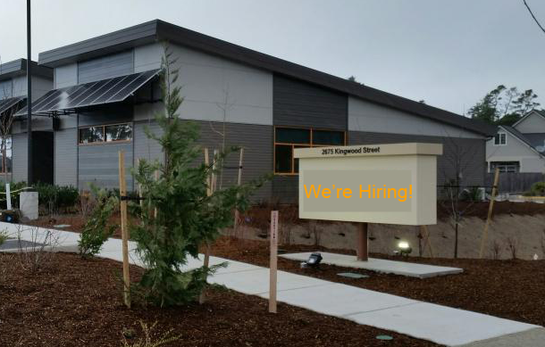
Please see the detailed job description and City employment application below. Applications can be mailed or hand delivered to Human Resources, City of Florence, 2675 Kingwood St, Florence, OR 97439; or emailed to recruitment@ci.florence.or.us.
Position is open until filled. Completed Applications must be received by that date and time. Application must be signed either physically or electronically to be eligible.
About the City
Our City staff and our community have embraced the City in Motion mantra. Check out our City of Florence: A City in Motion video on our website at www.ci.florence.or.us/citymanager/city-motion-video. The City Council and Management Team have outlined what it means to be a City in Motion and the exciting projects we have in store for our community. We are looking for someone who can join our City in Motion, embrace our mission and goals, and contribute to our vision of becoming Oregon’s Premier Coastal Community!
The City of Florence is an Equal Opportunity Employer.